One Bridge, Two Bridge, Red Bridge, Blue Bridge!

Actually, there are three, and all red.  (Sorry to disappoint.)

Sipapu

Kachina
Owachomo


I spent part of my last weekend at Natural Bridges National Monument, which is in Utah about two hours northeast of Hovenweep.


The main attraction at Natural Bridges is...natural bridges!  Similar to arches, but must have been formed by water flowing under them.  All bridges are arches, but not all arches are bridges.  (A brief refresher course: arches are defined essentially as holes in rocks, three feet or more in diameter, but can be formed by wind erosion rather than water.)

The bridges I saw were formed in Cedar Mesa Sandstone, which was deposited about 250 million years ago (MYA) during the Permian period.  This was also when the first "mammal-like reptiles" appeared on our planet, but just before the first dinosaurs.

This stuff gets complicated, so I find pictures useful.
The Cedar Mesa sandstone is part of the Cutler Formation.  Therefore, very old stuff.  The arches at Arches NP, you may remember, are formed in Entrada Sandstone, which was deposited about 150 MYA during the Jurassic period, when the first birds appeared.  At Hovenweep, I am surrounded mostly by Dakota sandstone, which was deposited at the start of the Cretaceous period about 130 MYA, when the first flowering plants appeared and shortly before the extinction of the dinosaurs.  ("Shortly" in geologic terms=several million years.)
I drove through over 100 million years of geology in two hours!

Notice awesome zebra-stripe streaks of desert varnish!  (Sipapu Bridge)
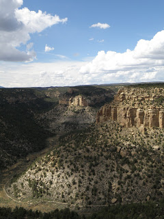
I hiked down to Sipapu Bridge, through the bottom of the canyon (which was beautiful in the afternoon light!) to Kachina Bridge, and back up again.  I passed by a ruin site called Horsecollar along the way.  There were supposed to be some ruins just past Kachina, too, but I managed to go in the wrong direction, get kind of lost, and never find them...

The Horsecollar site from down in the canyon.
Up close.

Sipapu, Kachina, and Owachomo are all words that come from the Hopi language.  The Hopi, who today live in northern Arizona, are among the largest of the tribes which claim descent from the Ancestral Puebloans.
Sipapu refers to the hole in the earth through which the Hopi emerged into the present world, the fourth world, from the third world, where (as in the two previous worlds) things had started to go badly.  Sipapus are represented in the floors of kivas today and were eight hundred years ago as well (see my entry on Mesa Verde for more about kivas).
A kachina is a spirit being which is central to the religious life of many contemporary Pueblo cultures.  "Kachina dancers," who wear elaborate masks representing the different spirits, play an important role in some ceremonies.  Hopi artisans also carve doll versions of kachinas which are used to teach children about traditions...and sold to tourists.

Kachina Bridge from above.
Picture of kachina dolls that I stole from Wikipedia.
Owachomo means "rock mound" in Hopi, referring to the rock formation on the top of the eastern end of the bridge (right side in the picture below).  I saved hiking to Owachomo Bridge for the next morning, and got up early enough to enjoy having it all to myself:

Owachomo is the thinnest of the bridges, likely because it is the oldest.
(Kachina is much wider as it is younger; less has been eroded away since its formation.)
After spending a lovely morning beneath Owachomo, I headed from Bridges toward the town of Bluff, UT...  But that, my friends, is another story.

Green Tables?

You may not have heard of Hovenweep, but you probably have heard of Mesa Verde.  Just a couple hours to the east, in Colorado, lies the famous National Park, home to incredible cliff dwellings that have survived more than seven centuries since being built.  These structures were built at the same time and in a similar manner to those at Hovenweep, they're just much bigger:

The famous "Cliff Palace"
A look at Spruce Tree House tucked into a natural sandstone alcove.
Soon after arriving at Hovenweep, I decided I'd better head to Mesa Verde so I could see for myself how it compared to the Hovenweep villages.  The main difference is that while each of the groups of ruins at Hovenweep was once simply a village, the enormous cliff dwellings of Mesa Verde probably served as some sort of gathering place for those living on the mesas all around, as well as housing some people permanently.

"Mesa Verde" means "Green Table" in Spanish.  See?

The Southwest is a land of mesas: flat lands often cut through
by rivers which create deep canyons.  This one is green.
Over two days, I was able to go on tours of three of the cliff dwellings--Cliff Palace, Balcony House, and Long House--and explore Spruce Tree House and Step House on my own.  I also got to see the Far View Sites, mesa-top dwellings more like those at Hovenweep, and the Badger House Community, where you'll find "pithouse" structures built around 650 AD, a few hundred years before the development of mesa-top architecture (which was soon followed by the building in alcoves, shortly before the Ancestral Pueblo People left the area for good).

The ladder I climbed up to enter Balcony House.
The original residents did make use of ladders, but would
have gotten down from the mesa tops by climbing, via
hand- and toe-holds carved into the rock.

Ranger Shannon standing in front of the seep spring at Long House.
Life at Hovenweep villages, also, was supported by seep springs at canyon heads.


See the little person?  Imagine how much time it took for people just
like him to build this entire village into the cliff!

Something I saw a lot of at Mesa Verde were kivas.  They were built all over this region, but none of those at Hovenweep are excavated for visitors to see, so this was the first time I got to look into them.  So what is a kiva?

Two kivas--the round rooms--at Long House.
Kiva is a Hopi word for very similar subterranean rooms that are built into the ground in their villages today, though theirs are usually flat-walled.  The Hopi are one of many American Indian tribes descended from the Ancestral Pueblo People, and so while no one can know what exactly these ancient round structures were used for, archaeologists extrapolate their purpose from the use of kivas in the Hopi culture and other contemporary Pueblo cultures (where they have different names in each different language).
Kivas today are used primarily for ceremonial purposes, and serve a central function in Hopi religious life.  These ancient kivas were at one time, and still sometimes are, assumed to have been used only for ceremonies as well, but artifacts and other evidence found within them has more recently indicated that they likely served more everyday needs as well.  Especially in the winter, they would have been a warm place to retreat to when the temperatures in the open desert dropped low.  Families may have done their cooking down in kivas and spent time on crafts such as weaving there.  The kivas seen above and below are of the most standard size, big enough to fit up to ten or fifteen people comfortably.  Elsewhere in the southwest, you can see "great kivas" able to accommodate four hundred!

Occassionally, kivas are keyhole-shaped!  We don't know why
they aren't all just round.
Kivas may have evolved from pithouses, and the two types of structures do have the obvious similarity of both being built into the ground.  However, there are places where both are found having been built around the same time in the same area, signifying some difference in purpose.

The remains of a pithouse built around 650 AD.
Though original roofs do not often remain on kivas "discovered" and excavated today, kivas were covered by flat roofs, with a single opening in the top for smoke to escape and people to climb in and out on a ladder.  Mesa Verde, as some other parks, has reconstructed one kiva so that visitors can go inside and see what it feels like.  I was surprised by how spacious it seemed, though it was small enough that I wouldn't have wanted to spend too long.  Part of the claustrophobic feeling may have been because the average Ancestral Puebloan was several inches shorter than me at 5'-5'3".  I could imagine these rooms being very comfortable spaces for them.

A boy climbs out of a reconstructed kiva into the sunlight.

Autumn leaves

Just because I'm in the desert doesn't mean I'm going to let myself miss a beautiful fall color show.  Unfortunately, plants out here don't really have leaves.
 
No self-respecting Seattleite could call these leaves.
Fortunately, I have found a solution: the mountains of Colorado, just a couple hours away!


Two weekends in a row, at the end of September and start of October, I escaped out to Colorado--first to an area in the San Juan National Forest just north of Mancos and next to the town of Telluride.  After that first weekend spent hiking around in the forest surrounded by beautiful yellow aspens, I knew I couldn't miss the rest of that short window when the trees light up before the coming of winter.

A walking trail in the Transfer recreation area, north of Mancos

I slept in campsites among aspens and among willows...

Transfer
Telluride
 Wandered past waterfalls and lakes (all that water that allows these trees to grow!)...

A little fall along a hike outside of Telluride
Reflections in Alta Lakes, just south of Telluride, where I camped for a night
Lovely pond at Town Park in Telluride
I saw some red and orange trees, too...
Red aspen, Telluride
Red oaks, Transfer
Colors mixing on the same branch!
I even saw some wild photographers!

Also taking advantage of the fall colors

I hope, dear reader, that you are enjoying the autumn wherever you are.

Aspens, Telluride

The Juniper

You may be wondering by now what on earth a juniper berry is.  Here you are:


Juniper trees are the only ones I see on a daily basis out here, each eking out a living on a patch of desert sand.  At a slightly higher elevation, you'll also find some pinyon pines, but other than that this country is a bunch of shrubs and rocks.  It's a far cry from what I'm used to in the rain-soaked Pacific Northwest, where big green trees line the city streets and moss creeps out of every corner, but I'm learning to love the desert landscape.

They frame things nicely, too.   Junipers around Hovenweep's Twin Towers.
Juniper berries are not actually berries.  They are cones with "unusally fleshy and merged scales" (says Wikipedia), which makes them look like little blue or purple-ish berries, but when you open them up you'll find a hard seed on the inside.

It was while trying to peel off the outer layer of a juniper berry to see exactly what was under its skin that I finally came up with a name for my blog.  Wandering among juniper forests and especially if you smell the leaves--which seem to be more scaley needle-like things than leaves--up close, you'll notice a very faint sweet smell coming from them.  This scent is intensely magnified when you peel open a juniper berry and the sticky inside is smeared over your fingers.  I had a realization that this was one of my favorite things about the desert, this delicious smell.  It reminds me of pine sap from back home, but tinged with a distinctive desert flavor, a honey-like scent that only comes from this place.

You should smell the desert when it rains; when the juniper and sagebrush and sand-dirt that covers everything mix with water droplets to fill up every bit of the air.  It is as wonderfully refreshing as the just-rained smell you get back in the northwest (or other places with ground that has actual dirt on it and smells "earthy") but here it comes with a unique desert sweetness, that hint of honey-like juniper and extra sense of renewal that even the slightest rainfall brings to such a dry land.


Anyway, those juniper berries, to me, are one of the "sweetest things in the desert," along with the amazing sense of solitude one finds out here, in a landscape where there is so much room to explore and little to get in the way of your thoughts.

It turns out different varieties of juniper trees grow all over the Northern Hemisphere.  The one I'm most familiar with is the Utah Juniper, or Juniperus osteosperma.  Besides juniper berries, they grow these really interesting things called galls which are growths caused by the Juniper Tip Midge, but are actually quite pretty:


Two thousand arches!

On my first weekend since beginning work at Hovenweep, I took off for Moab, UT (a 2 1/2 hour drive away).  Moab is a great little city surrounded by beautiful red rock cliffs, and is just minutes from Arches National Park, one of the most-visited in the country.  It's famous for housing over two thousand natural sandstone arches--defined as any opening at least three feet in diameter, though many are much larger.


I stayed for three days with a fellow SCA intern who is working this summer at Arches, which gave me time to explore all sorts of incredible things in the park.  I saw some of the famous sites like Balanced Rock and Delicate Arch, and also hike out to less-traveled areas like the "Devil's Garden," where you'll find Double-O Arch.  But the best way to describe all of this, of course, is in pictures!

Balanced Rock


A rainbow at Delicate Arch just before sunset


The "Three Gossips" at sunset
Double Arch, one of my favorites


Most arches--and other really interesting rock shapes--are formed in the Entrada Sandstone, a layer of sedimentary rock deposited about 200 to 150 million years ago.  (A reference point for any Questers: the Entrada layer is just above the Carmel Formation, which is above the Navajo Sandstone, the highest-up and latest-deposited layer we encountered very much of on the Green River.  So this Entrada sandstone is somewhat younger.)

Now, one thing that's been difficult for me is to get any pictures of myself on my adventures, as I'm traveling alone.  The secret solution?  Pick a guy who's carrying around a big fancy camera, and ask him to take a picture of you!

At the South Window.
Arches is a huge park, and there are even more interesting things to do there besides look at arches.  One is to take a tour of the "Fiery Furnace," an incredible maze of sandstone "fins," out of which arches are formed once water or wind erosion pokes a hole in them.  The fins are formed from the weathering away of sandstone around cracks made in the rock as the earth shifts over hundreds of years.

The Fiery Furnace
There's a joke among the rangers at Arches that "the Fiery Furnace is full of rainbows and unicorns" because they have to deal with a large number of visitors whining and screaming about not being allowed to go in.  Only a small number are allowed to enter each day, and only on ranger-guided tours, because it's a place where you could easily get lost wandering through the thin openings in the rocks if you don't know exactly where you're going.  The tours are often booked weeks ahead of time, so people who wait until the day they arrive to demand entrance into this area of the park are almost always disappointed.  Very lucky for me, a tour on the Monday I was there had openings!  And because I am an SCA at a nearby park, I am both automatically well-connected and taken pity on because I make only $75 a week.  So I got to go into the Fiery Furnace for free :)

Descending into the Fiery Furnace


Coming up on Surprise Arch--wow!


And that's only a small slice of what I got to see and do on my weekend at Arches National Park, but this is getting quite long, so I'll sign off with a few more of my favorite photos.

Landscape Arch at sunrise--290 feet across!

Double-O Arch: two arches stacked on top of each other!

An excellent example of "fins"

"Lasagna Rock" as a thunderstorm rolls in.
I just made up that name because I was so fond of this rock,
but the Dewey Bridge member of the Carmel Formation,
from which it is formed, is sometimes called the "lasagna layer"

Sunset behind sagebrush,  a plant you grow to love
if you spend enough time out in the desert.